About:
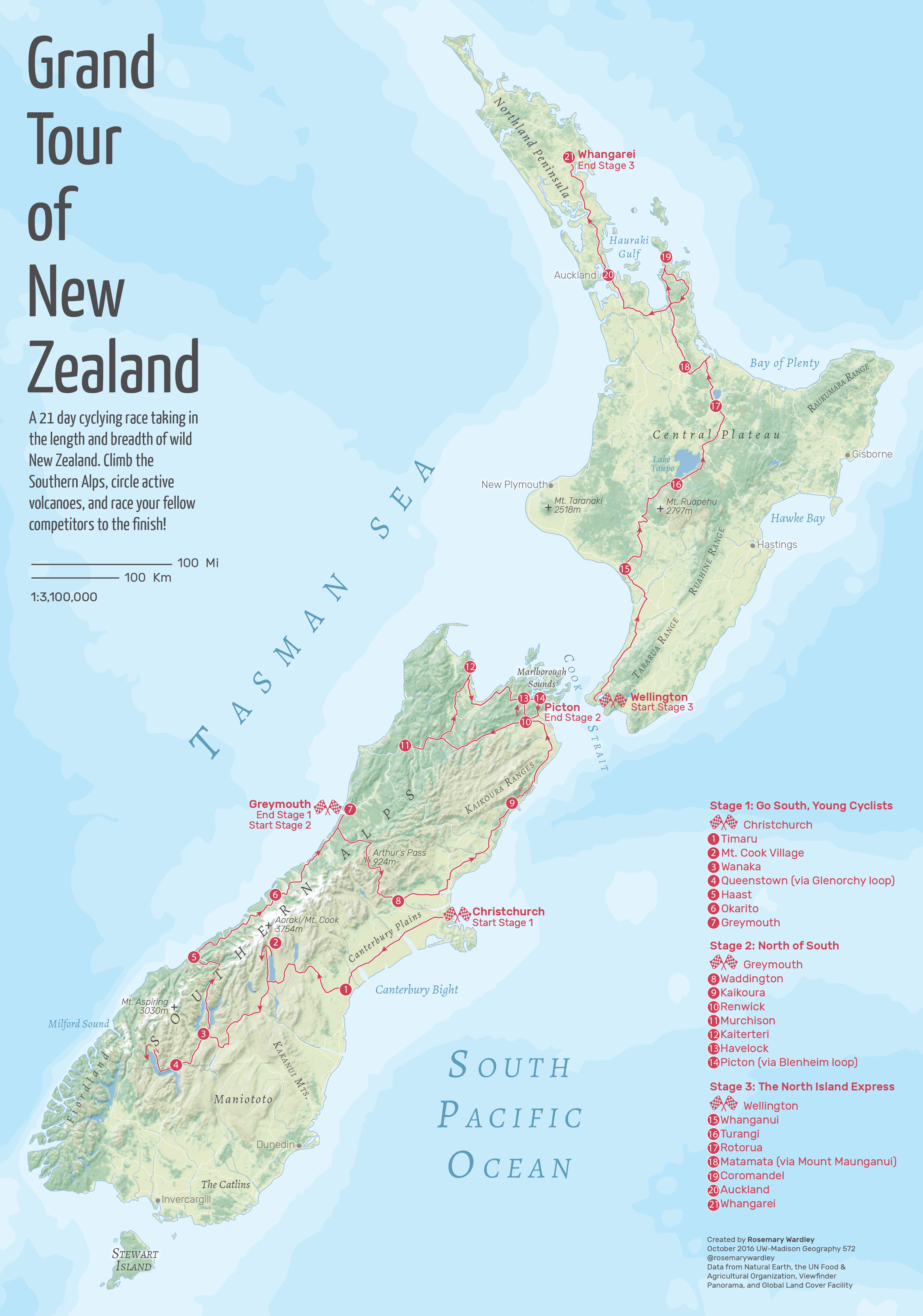
Creating a terrain map from start to finish has been a goal of mine for many years, and so has making a map of New Zealand! So I jumped at the opportunity to check 2 items of my to-do list with this lab project! Plus, you won't find a more dynamic physical geography to liven up your terrain then in the two islands of New Zealand.
Process:
The purpose of this lab was to practice creating realistic terrain, but to also create a map with strong visual hierarchy. Displaying the route for the bike race is the main goal, so it was imperative to create background relief that didn't pull too much attention away from that, but that complimented the story being told.
Outcome:
I learned through this lab that there are many different ways to create relief and it truly remains one of the most articstic cartographic expressions. I used Pyramid Shader to create my terrain and PhotoShop to blend it with the land cover and other datasets, but I look forward to trying many of the other tools. I enjoyed reliving my vacation to New Zealand by retracing (most) of our steps through the bike route. And it was fun to research the names of the many physical features that were visible in the terrain.